| RSS | EN | DE | EL | ES | FR | IT | RU

Nevados de Chillán Volcán

Updated: 12 jul. 2026 01:03 GMT -
stratovolcano
Central Chile, -36.86°S / -71.38°W
Summit height: 3212 m / 10,538 ft
Current status: minor activity or eruption warning (3 out of 5)
Last update: 2 jul 2026 (Smithsonian / USGS Weekly Volcanic Activity Report)
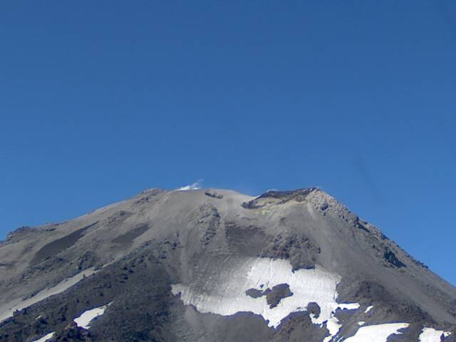
Nevados de Chillán volcano (SERNAGEOMIN webcam)

Nevados de Chillán volcano in central Chile is one of the country's most active volcanoes. It is part of the Southern Volcanic Zone of the Andean Cordillera, and is composed by 3 overlapping stratovolcanoes located on a NNW-SSE-trending line.

[smaller] [larger]
Typical eruption style: explosive
Erupciones del volcán Nevados de Chillán: 2016-ongoing, 2009, 2003, 1973-86, 1972, 1965, 1946-48, 1945, 1934, 1929, 1923, 1906, 1898, 1891, 1883, 1877, 1872, 1861-65, 1752, 1750-51, 1650

Latest nearby earthquakes

Fecha y horaMag / Prof.Distancia / Ubicación

Background

The complex cone of Nevados de Chillán sits on a basement of granitic intrusive rocks and Cenozoic lavas. Its main vents extend along a 10 km long NE trending ridge.
3 younger stratovolcanoes were constructed along a NNW-SSE line of 3 nested Pleistocene calderas, which produced ignimbrite sheets extending more than 100 km into the Central Depression of Chile.
The largest stratovolcano, dominantly andesitic, 3212-m-high Cerro Blanco (Volcán Nevado), is located at the NW end of the group.
3089-m-high Volcán Viejo (Volcán Chillán), which was the main active vent during the 17th-19th centuries, occupies the SE end.
The new Volcán Nuevo lava-dome complex formed between 1906 and 1945 between the two volcanoes and grew to exceed Volcán Viejo in altitude. The Volcán Arrau dome complex was constructed SE of Volcán Nuevo between 1973 and 1986, eventually exceeding its height by 20 m.
---
Source: GVP Nevados de Chillán volcano information

Erupciones volcánicas significativas: Nevados de Chillán volcano

In the past 10,000 years, Nevados de Chillán has had at least 26 confirmed volcanic eruptions, out of which 22 are documented by historical records, while the others can be inferred from geological evidence.
Additionally, there are 6 uncertain or discredited eruptions from Nevados de Chillán volcano.
The table below lists all known eruptions (date in bold face) of Nevados de Chillán volcano since around 1800. Updates on the most recent volcanic activity of Nevados de Chillán can be found on the news page of Nevados de Chillán volcano.
FechaNotaVEIFallecidosDaños
2016 ene 8 - 2022 oct 17Nicanor crater
Obs. históricas/documentos
2
desconocido
?? 2009 ene 21 - ene 22
Erupción incierta
?
desconocido
2003 ago 29 - sep 15 ±5 d.Saddle between Nuevo & Arrau volcanoes
Obs. históricas/documentos
1
desconocido
1973 jul 16 ±15 d. - 1986 jul 2 ±182 d.Volcán Arrau (SE flank of Volcán Nuevo)
Obs. históricas/documentos
2
desconocido
?? 1972 jul 2 ±182 d.
Erupción incierta
?
desconocido
?? 1965 jul 2 ±182 d.
Erupción incierta
?
desconocido
1946 - 1947Volcán Nuevo
Obs. históricas/documentos
2?
desconocido
?? 1945
Erupción incierta
?
desconocido
1935 jul 2West flank of Volcán Viejo
Obs. históricas/documentos
2?
desconocido
1934 ene 17Volcán Nuevo
Obs. históricas/documentos
2?
desconocido
1928 nov 30 - 1929Volcán Nuevo
Obs. históricas/documentos
2?
desconocido
1927 abr 10Volcán Nuevo
Obs. históricas/documentos
2?
desconocido
?? 1923
Erupción incierta
2?
desconocido
1914Volcán Nuevo
Obs. históricas/documentos
2
desconocido
1906 ago 6 - dicVolcán Nuevo
Obs. históricas/documentos
2
desconocido
1907Volcán Nuevo
Obs. históricas/documentos
1
desconocido
1898Volcán Viejo
Obs. históricas/documentos
2
desconocido
1893 mar 4Volcán Viejo
Obs. históricas/documentos
2
desconocido
1891 febVolcán Viejo
Obs. históricas/documentos
2
desconocido
?? 1883 ene 21
Erupción incierta
2?
desconocido
1877 feb 12 ?Volcán Chillán
Obs. históricas/documentos
2
desconocido
1872 jul 22Volcán Chillán
Obs. históricas/documentos
2
desconocido
1864 nov 30 - 1865 feb 3 ±1 d.NW flank of Cerro Blanco (Santa Gertrudis)
Obs. históricas/documentos
3
desconocido
1861 jun - 1863NW flank of Cerro Blanco (Santa Gertrudis)
Obs. históricas/documentos
2
desconocido
1860 jul 25W flank of Volcán Viejo (Volcán Renegado)
Obs. históricas/documentos
2?
desconocido
Remark:
Our list of volcanic eruptions closely follows the database of eruptions of the Smithsonian's Global Volcanism Project (GVP), the internationally most recognized data source for volcanic eruptions, but also includes significant eruptive episodes or related volcano events. "Volcanic eruptions" are usually to be understood as sequences of individual eruptive episodes that can follow each other, or even overlap (if several vents are involved), and can last many years, decades or even longer. For example, the current activity of Stromboli volcano is understood as a single eruption that has been ongoing since 1934.
Fuentes: NOAA National Centers for Environmental Information (NCEI), Global Significant Volcanic Eruptions Database. doi:10.7289/V5TD9V7K | Global Volcanism Project / Smithsonian Institution

Erupciones del volcán Nevados de Chillán


2009 eruption
Based on satellite imagery, Nevados de Chillán volcano had an eruption in January 2009. An ash plume was detected that rose to 3.7-6.1 km (12,000-20,000 ft) altitude on 21-22 January and drifted 50-80 km SE.

2003 eruption
Small eruptions occurred for over the week ending 27 August 2003, with ash columns up to heights of 500 m. The eruptions produced a new double crater in the saddle between the cones Nuevo (which erupted during 1906-1945) and Arrau (which erupted during 1973-1986). Eruptions occurred at Las Termas subcomplex.

1861-65 eruptions
The eruptions between 1861-65 occurred on the NW flank of Cerro Blanco subcomplex from the Santa Gertrudis cone and produced a new lava field.
The main phase of the eruption occurred during August 1861, in the height of the Austral winter, when seasonal snow covered the upper flanks of the volcano. Powerful strombolian explosions sent incandescent bombs high into the sky and could be seen at night from Chillan town 80 km to the west. At the same time, strong ash eruptions occurred and an earthquake was felt in Chillan. Ash fall turned water cloudy in Nuble River 20 km to the north. On 22 August 1861, lava flows were erupted. From February 1862 until 1863, strombolian explosions continued with small lava fountains near the vent.
---
Source:
K. Mee, H. Tuffen and J. S. Gilbert (2006) "Snow-contact volcanic facies and their use in determining past eruptive environments at Nevados de Chillán volcano, Chile", Bull. Volc., Volume 68, Number 4, 363-376

Nevados de Chillán Volcano FAQ

+When was the last eruption of Nevados de Chillán volcano?

+How often does Nevados de Chillán volcano erupt?

+How active is Nevados de Chillán volcano at present?

+When was the largest eruption of Nevados de Chillán volcano?

Últimas imágenes satelitales

nevadosdechillan imagen satelital sat1nevadosdechillan imagen satelital sat2

Nevados de Chillán Volcán Mapas
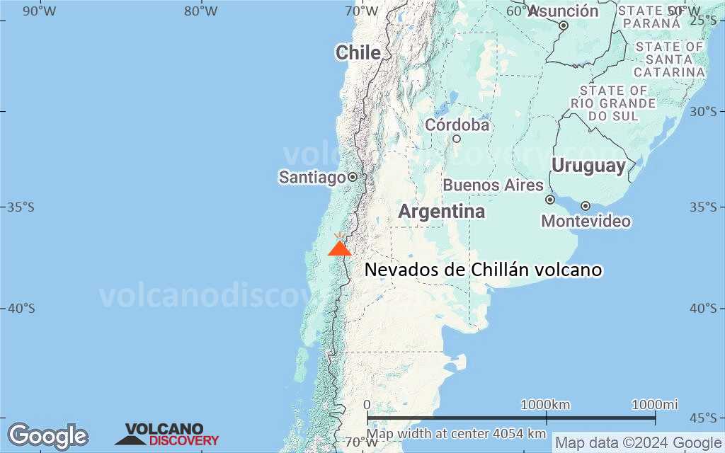
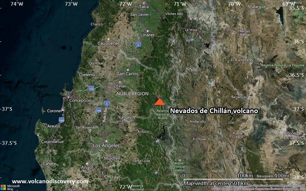
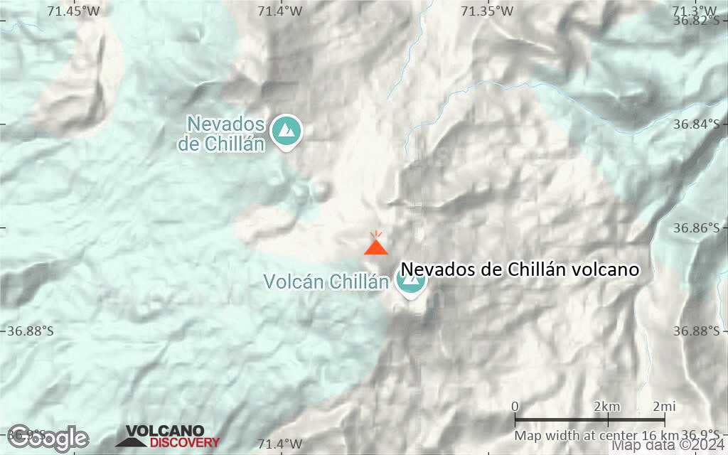
Below is a selection of maps showing the location and surroundings of the volcano at various resolutions based on aerial-imagery / terrain maps. Feel free to use them for non-commercial purposes on your blog or website as long as you credit them with a link back to this page (click to copy it).

Satellite/aerial-type map of Nevados de Chillán volcano (world scale)
Terrain-type map of Nevados de Chillán volcano (world scale)
Satellite/aerial-type map of Nevados de Chillán volcano (region scale large)
Terrain-type map of Nevados de Chillán volcano (region scale large)
Satellite/aerial-type map of Nevados de Chillán volcano (region scale medium)
Terrain-type map of Nevados de Chillán volcano (region scale medium)
Satellite/aerial-type map of Nevados de Chillán volcano (region scale small)
Terrain-type map of Nevados de Chillán volcano (region scale small)
Satellite/aerial-type map of Nevados de Chillán volcano (local scale large)
Terrain-type map of Nevados de Chillán volcano (local scale large)
Satellite/aerial-type map of Nevados de Chillán volcano (local scale medium)
Terrain-type map of Nevados de Chillán volcano (local scale medium)
Satellite/aerial-type map of Nevados de Chillán volcano (local scale small)
Terrain-type map of Nevados de Chillán volcano (local scale small)
Satellite/aerial-type map of Nevados de Chillán volcano (scale of 10s of km)
Terrain-type map of Nevados de Chillán volcano (scale of 10s of km)
Satellite/aerial-type map of Nevados de Chillán volcano (scale of 20-40 km)
Terrain-type map of Nevados de Chillán volcano (scale of 20-40 km)
Satellite/aerial-type map of Nevados de Chillán volcano (scale of approx. 10-20 km)
Terrain-type map of Nevados de Chillán volcano (scale of approx. 10-20 km)
Satellite/aerial-type map of Nevados de Chillán volcano (scale of 5-10 km)
Satellite/aerial-type map of Nevados de Chillán volcano (scale of few kilometers)
Volcanoes & Earthquakes - app for Android
Guaranteed tours
12-28 jul 2026: From Bali to Flores - Java (Indonesia)
2-18 ago 2026: From Krakatau to Bali - Java (Indonesia)
14-30 ago 2026: Volcanoes and Spices - Halmahera N-Sulawesi (Indonesia)
19 sep - 3 oct 2026: Green Volcanoes - Azores (Portugal)
5-21 oct 2026: From Krakatau to Bali - Java (Indonesia)
6-22 nov 2026: Volcanoes and Spices - Halmahera N-Sulawesi (Indonesia)
8-24 nov 2026: From Bali to Flores - Java (Indonesia)
3-9 may 2027: Fascination Volcano - Santorini Island, Greece
26 may - 6 jun 2027: Land of History - Armenia
= spaces available   = guaranteed   = few spaces left   = booked out
Map of the Nevados de Chillán complex (Sernageomin)

Nevados de Chillan Volcano (Chile) – Activity Report 25 Jun–1 Jul 2026 (New Eruptive Activity)

Thursday, Jul 2, 2026 | 9 days ago · VN
The Servicio Nacional de Geología y Minería (SERNAGEOMIN) reported that at 1100 on 26 June an ash plume at Nevados de Chillán rose around 380 m above the crater rim and drifted SE. The Alert Level rem…

Nevados de Chillan Volcano (Chile) – Activity Report 11–17 Jun 2026 (New Eruptive Activity)

Thursday, Jun 18, 2026 | 23 days ago · VN
The Servicio Nacional de Geología y Minería (SERNAGEOMIN), Servicio Nacional de Prevención y Respuesta ante Desastres (SENAPRED), and the Servicio Geológico Minero Argentino (SEGEMAR) reported ash plumes at Nevados de Chillán. Beginning at the end of February, the seismic network recorded a sustaine…

En esta página:

Try our free app!
Volcanoes & Earthquakes - new app for Android
Android | iOS version

More on VolcanoDiscovery

Why is there advertising on this site?

¡Apóyanos – Ayúdanos a mejorar nuestros servicios!

Nos encanta trabajar para traerte los datos más recientes sobre volcanes y terremotos de todo el mundo, solo para ti. Sin embargo, mantener nuestro sitio web y nuestras aplicaciones gratuitas requiere mucho tiempo, esfuerzo y recursos.
Tu apoyo nos permite ampliar la capacidad de nuestro hardware y software, así como fortalecer a nuestro equipo editorial. Nuestra misión es ofrecer actualizaciones continuas en tiempo real siempre que ocurra un terremoto o una erupción volcánica — ¡y tus donaciones lo hacen posible! Cada contribución, grande o pequeña, es profundamente apreciada. Si encuentras útil la información que ofrecemos y deseas ayudarnos a integrar nuevas funciones, crear contenido atractivo y mejorar nuestra tecnología, por favor considera hacer una donación:

Usa PayPal:

Funciones planeadas:

Gracias a tus donaciones anteriores, recientemente hemos añadido:
Descarga la app Volcanes & Terremotos para ser de los primeros en recibir alertas rápidas en línea sobre terremotos y volcanes:
Android | iOS
¡Gracias por formar parte de nuestra misión!
Sources: VolcanoDiscovery / VolcanoAdventures and other sources as noted.
Use of material: Most text and images on our websites are owned by us. Re-use is generally not permitted without authorization. Contact us for licensing rights.
Volcanoes & Earthquakes
VolcanoDiscovery Home
Volcanes | Sismos | Fotos | News | | Shop | App
Adventure & Study Travel
Tours to Volcanoes and Volcanic Areas: walking tours, photo tours, study tours
Tours & Dates | FAQ | About us
Get our newsletter!
Company info
Contact | Legal info | Terms & conditions
Follow us
Follow us on facebook Follow us on Instagram Follow us on Bluesky Follow us on Twitter Visit our Youtube channel
EN | DE | EL | ES | FR | IT | RU
VolcanoDiscovery GmbH, Germany, Reg. nr.: HRB 103744, EU Tax Id: DE 297 465 123 owned and created by
Dr. Tom Pfeiffer, volcanologist, volcano photographer, tour organizer member of
IAVCEI
IAVCEI
Vulkanologische Gesellschaft
Volcanological Society
Ecotourism Greece
Ecotourism Greece
RUV insurance
Insured by R+V
VolcanoDiscovery © 2004- All Rights Reserved | Privacy - Cookie Settings