1-day tour around Villarrica volcano
Day 1: Full day on Villarrica
Start of the tour in the front of town council Pucon
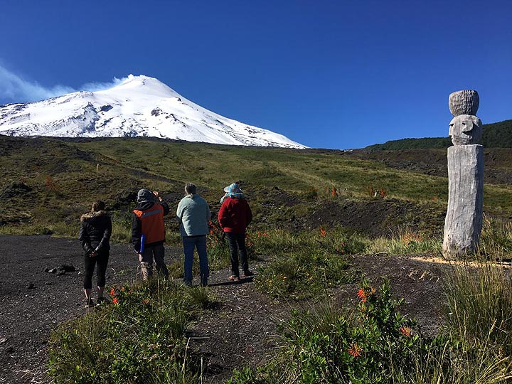
Stop 1: Mapuche sacred altar
In the native Mapuche religion, inside the sacred Villarrica volcano there are four powerful spirits, one for each element. In the face of an imminent eruption, the Mapuche´s perform a ceremony in this place called "Guillatun", to appease the spirits.
(distance: 13 km / elevation: 1162 m)
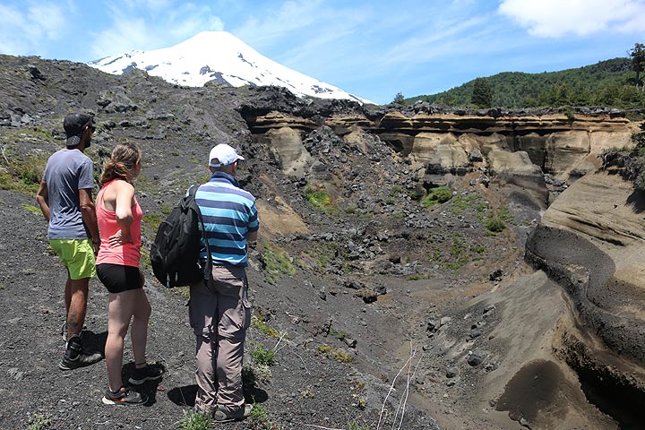
Stop 2: How a volcanologist interprets volcanic deposits
This place of interest shows the sequence of most of the youngest eruptions of Villarrica. At the base, a 3700 years BP old sequence of deposits known as "Pucon Ignimbrites" from a cataclysmic caldera forming eruption. In the middle, deposits from pyroclastic flow´s and pyroclastic fall. The upper segment shows pyroclastic fall deposits and pahoehoe lava flows eroded by lahars.
(distance: 13 km / elevation: 1149 m)
Stop 3: The last eruption in 2015: lahar path
Zanjón Seco-Carmelito historical lahar paths. 20 minutes after the start of the strombolian lava fountain on March 3, 2015, a hyperconcentrated lahar crossed this point and left behind more than 2 meters high boulders. This represents the huge potential destruction power of lahars, responsible for the death of more than 100 people during the last century.
(distance: 13 km / elevation: 829 m)
Stop 4: Earth History: From the ice age to the present
Morain, pyroclastic flow deposits, and the orange layer, is the Mocho-Choshuenco (50 km to the south) pumice from a plinian eruption (~10.000 PB).
(distance: 17 km / elevation: 868 m)
Stop 5: The power of nature.
Walk along a 300 m path to the lake. The small crevasses on the earth are from the 8.8 Maule earthquake of 2010. Later, on the left side, a 18 m long concrete bridge segment, carried 300 m by the lahar of December 1971.
(distance: 33 km / elevation: 221 m)
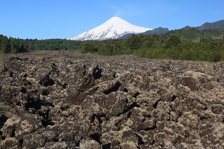
Stop 6: 14 km long andesitic lava flow of 1971
We observe the flow of andesitic lava or "aa" type from the fissure eruption of 1971, in an extension of almost 2 kilometers. This place not only arouses our admiration for the dynamic earth, it also instills an enormous inner peace.
(distance: 81 km / elevation: 391 m)
Stop 7: Conaripe: Lahar path of 1964, memorial site
March, 1964, 22 people was killed by a 4 meter high lahar wave. The eruption was by night, during heavy rain. The town was warned by a farmer by horse few minutes before lahar arrived, but only a few was able to find a safe place in the darkness.
(distance: 95 km / elevation: 210 m)
Stop 8: Liquiñe-Ofqui Tectonic Fault (FLO)
The Calafquén lake, of glacial origin. In the background, a view of the 1,200 km long active Liquiñe-Ofqui tectonic fault , source of hot springs and volcanism.Massive pumice deposits from Neltume plinian eruption from Mocho-Choshuenco volcano (~10,000 BP).
(distance: 100 km / elevation: 210 m)